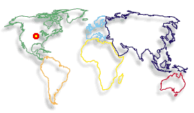
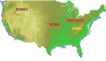
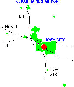
An informative answer to this question depends on your context. The map to the left shows that we are in North America. But to many Europeans and, alas, to many residents of the United States, there is some confusion between the states Iowa, Ohio, and Idaho. Perhaps this is due to the high proportion of vowels in these names, or perhaps due to the aboriginal etymology behind these names. The map below shows where Iowa is located in relation to Ohio and Idaho; the state of Iowa is rather near the center of the continental portion of the United States. The city of Chicago is located approximately where the C of "Chicago" appears on the map. Most visitors to the University of Iowa book flights that make connections through Chicago, which is about 350 kilometers (220 miles) from our campus. The airport closest to Iowa City is just south of Cedar Rapids, which is approximately 60 kilometers (38 miles) to the north of the university. Cedar Rapids is a town of about 175,00 inhabitants; there are also flights to and from Saint Louis, Dallas, and Denver (depending on the financial health of the airline industry). The next nearest airport is in Moline, Illinois, about 100 kilometers (65 miles) away. Des Moines, the capitol city of Iowa, is just under 200 kilometers away, and the other major research university in Iowa, Iowa State University, is about 220 kilometers driving distance from our department (it can be managed in two hours of driving, plus extra time for finding a parking place).
The Iowa River flows through Iowa City, and part of the University of Iowa campus is adjacent to the river (follow this link for maps of the campus and surroundings). The building of the Computer Science Department, is located near the center of the red circle on the following map of the central part of Iowa City.
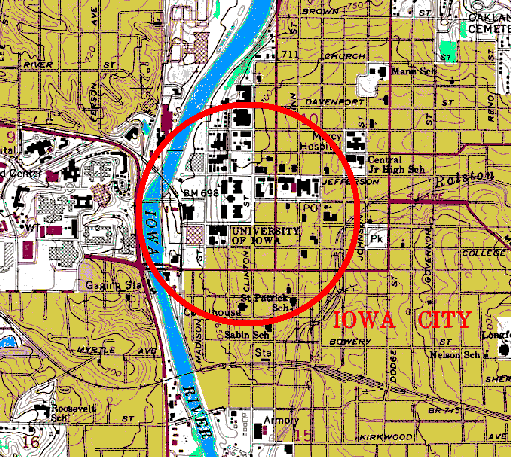
In late January, the coldest part of the winter, Bald Eagles can sometimes be seen beside the river, within the red circle on the map.