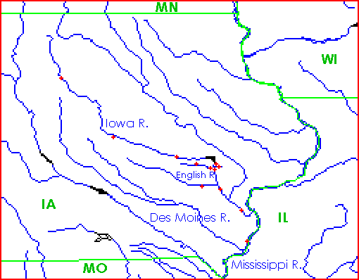
IOWA RIVER BASIN MAP

- Reservoirs: The Coralville Reservoir is marked in black near
the center of the map.
The Saylorville and Red Rock Reservoirs are marked in black along the
Des Moines River on the left of the map.
(They lie just upstream and downstream, respectively, of the city of
Des Moines.)
- Streamflow gages: The streamflow gages included in the "Iowa River
& Coralville Dam Information" page are marked here with red crosses.
Beginning at the top (upstream), the Iowa River gages
are in or near the towns of Rowan, Marshalltown, Marengo,
Coralville Dam tailwater, Iowa City, Lone Tree, and Wapello.
Just below the Dam to the east is the Rapid Creek gage.
Just above Iowa City to the west are the Oxford and Coralville gages
on Clear Creek.
Just below Iowa City to the west is the Kalona gage on the English River.
Finally, below Wapello is the Mississippi River gage at Burlington.
The map shown here is based on one made with the
Xerox PARC map viewer.
Last updated on Feb 11, 2017 by CRN

